Okay, second night with my fitness tracker, and Gadgetbridge shows light sleep for almost 8 hours (and also a few counted steps in the flat). After reading a bit more about the software, I’ve changed my weather provider on the phone to “Tiny Weather Forecast Germany” which comes from our official DWD (Deutscher Wetterdienst) site who are also reporting to Tagesschau and other official media. That one is nicely integrated with Gadgetbridge, so that my fitness tracker now shows the temperatures as reported by DWD, instead of some unknown Chinese service.
I also changed my phone’s navigation system from Organic Maps to OsmAnd~ which is supported by Gadgetbridge (even Google Maps is supported, but any Google services is what I’m trying to avoid with all this). I have not yet tried any “Activities” or “Workouts” which would make use of map tracking, but I will do that soon (next on my list in fact).
Anyway, it’s nice to know that communications only occur between my own devices now, and that *nothing* goes to some unknown “cloud services” (aka other peoples’ computers). Except of course the fact that my phone gets the weather from DWD, so it also has to tell them where I am to keep that correct. That’s unavoidable, but I can live with that…
And like always, thanks for reading.
Update to this update 😉
Just saw that the battery status was different on the device and in the software, so I submitted a bug report against Gadgetbridge. See here.
And another update to this update (of the update) 😉
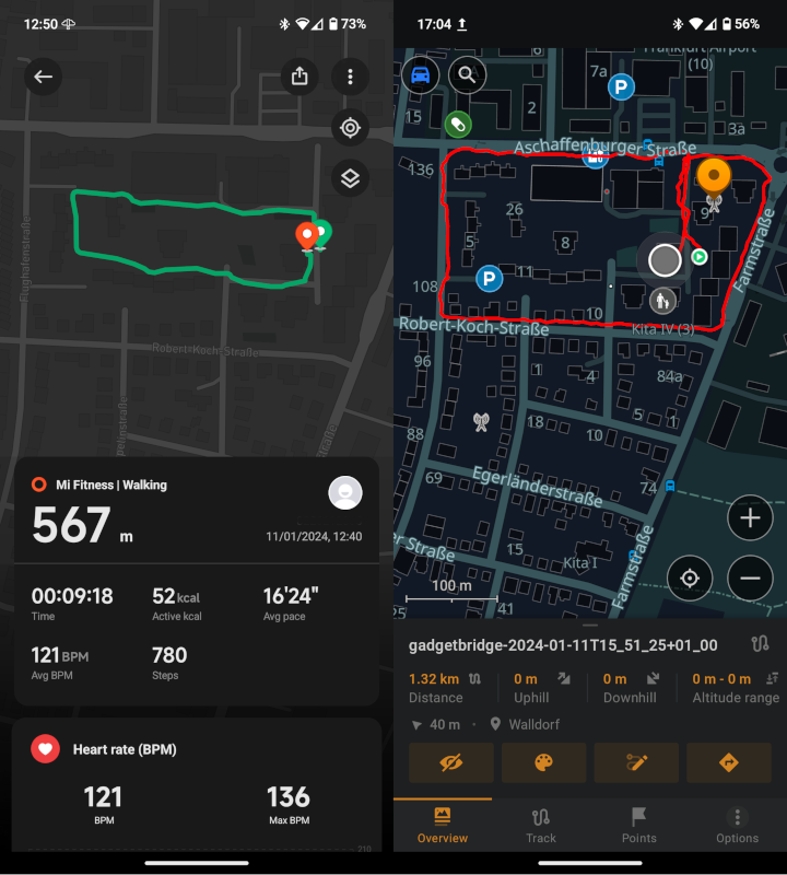
Yup; tracking works. First I didn’t exactly know how to *get it working*, so I tried with the Mi Fitness app first, but later found out how to view the “workout” in OsmAnd~. Here is how that looks:

In the Mi Fitness screenshot, I had to take out my “customer number” (or whatever they call your digit-only user number at Xiaomi), so I airbrushed that out with The Gimp. Gadgetbridge and OsmAnd~ show nothing personal, except of course the area where we live. Took the small inner round through our “Wohnpark” in the Mi Fitness image, the bigger around the block walk in Gadgetbridge/OsmAnd~.
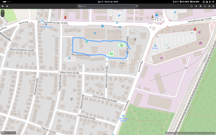
You can also export a .gpx file from Gadgetbridge, which is what I did to import it into Gnome Maps on my desktop – looks like this (with a shorter walk):

Not bad for “experimental”, is it? Again, thanks for reading and for viewing.
